While this is not officially an installment in the Alternate History series, you might want to see Alternate History #5, Colonial Japan.
"Predating the launch of Sputnik by over a century, President Taylor's task force, consisting of civil engineers and frontiersmen, constructs a rocket in the Californian wilderness, equips its payload with the most powerful camera known to humankind at the time - endowed with revolutionary colour-capturing capacity - and launches it skyward from the slopes of Mount Whitney.* The President's Astro-Physical Expedition (APE) put California's local flora to good use, hollowing out a redwood tree and stuffing it with gunpowder to create a giant firing tube."
Redwoods are pretty cool but they're not that cool. (I'm trying to grow one in my house at the moment, from cloning instead of from cones, which are ironically tiny.) But this post at Strange Maps, featuring a reconstruction of 1851 California by Mark Clark, shows what that redwood-launched camera would have seen:

The Central Valley was much wetter back then - a temperate river valley. Although I imagine it would have been buggy as all get-out. Ever drive through the rice regions north of Sacramento in the summer at dusk? Your windshield looks like somebody covered it with brown mustard. (Delicious.) Also noticeable on this map: still-full Owens Lake (California's own Aral Sea), and the still-green grasslands and coastal marshes of Silicon Valley and Los Angeles.
*If you read that and thought "Well now who's going to drag that whole contraption all the way up to the top of Mt. Whitney", strangely, this detail is not the most unlikely of the whole scenario. In the nineteenth century it used be thought that the highest mountain in the world was Ecuador's Chimborazo volcano (20,565') - and indeed, it is the farthest from the center of the Earth. Substituting distance-from-center is a neat trick to figure out the highest mountain, but it gives the wrong answer, because the Earth spins, and is mostly liquid, so it's slightly oblate (flattens like an M&M), adding a few more miles onto the distance-to-center at the equator - which is why Everest, up in the 30's north latitude, loses this contest to equatorial Chimborazo. (But Everest is still the highest above sea level.) Point being, how did the scientists measure this? By dragging a >1,000 lb.-yet-delicate metal instrument up to the summit of Chimborazo! Dragging a hollowed-out redwood to the top of merely 14,496' Whitney would be a picnic by comparison.
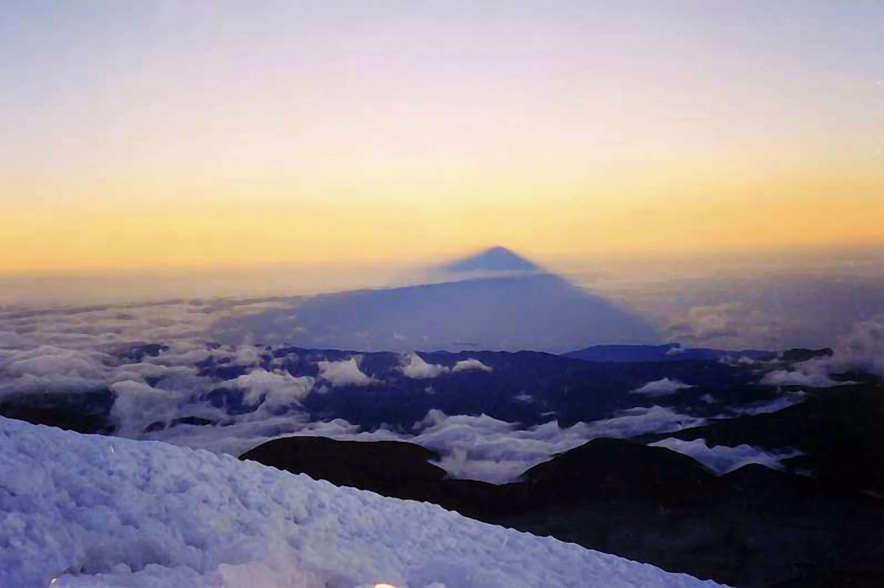
Looking west from the top of Chimborazo at dawn, where the shadow is projected out to the horizon. Look familiar? Picture in the banner at the link is the same effect from Mt. Hood in Oregon.
No comments:
Post a Comment